For the last 8 and ½ weeks we've been working in a kiwifruit packhouse in Kerikeri, hence why the posts have been a bit few and far between. It has been a good way to replenish our funds quickly but we've also had to work some pretty long hours doing up to 70 hours a week during the peak of the season. But at the least the work is consistent unlike what can be said about fruit picking...
To the left are the green kiwifruits and to the right the gold ones!
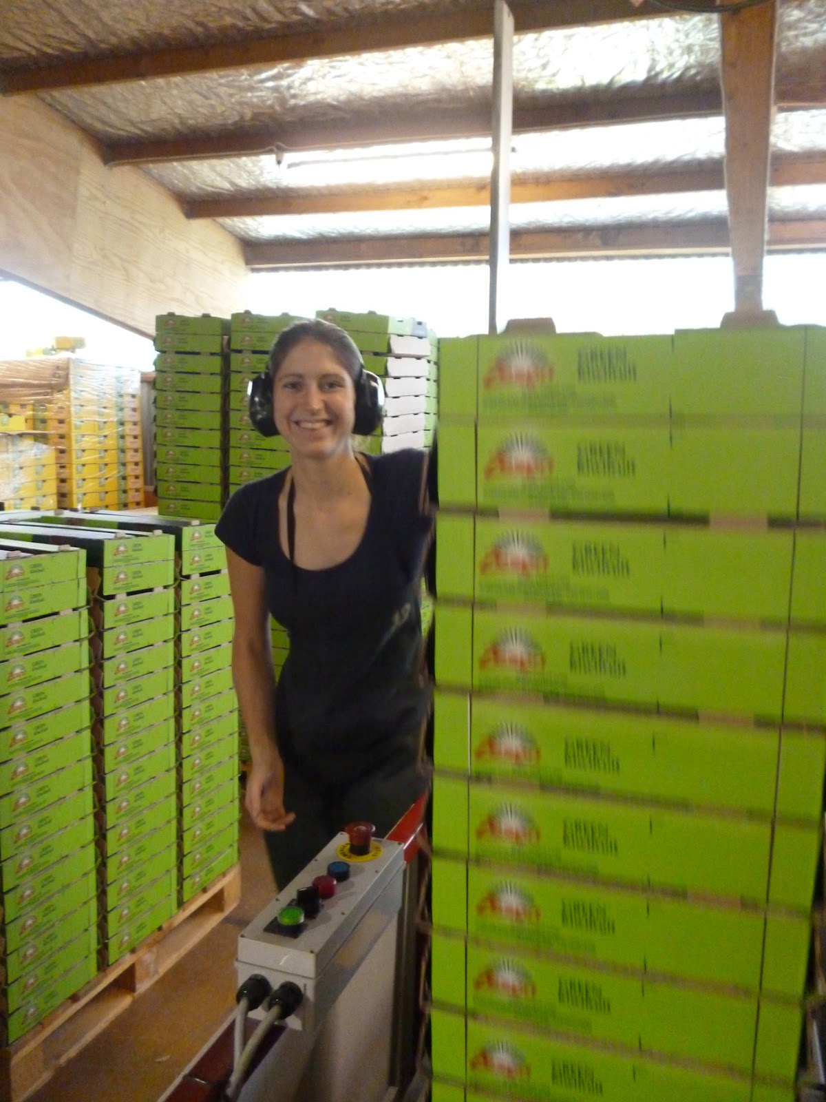
In a nutshell, our main role was to make the boxes that the kiwifruits were packed into, which was as boring and repetitive as it sounds!
Our employers the past two months, LD Packers in Kerikeri
Boxes, boxes everywhere!
Lizzie stacking trays on the "IT machine"
Me stacking on the "ML machine"
It's a serious business running these machines!
Lizzie loading card onto the ML machine
Often the hours were long and arduous, the packhouse was noisy and dusty, and more often than not we'd finish the day feeling like shit with lots of aches, pains and paper cuts, but at least we came through the season with a great bunch of friends we made along the way, despite being let down by some others... It was an experience that I'll never forget but equally hope to never repeat unless I can help it! We even got some brief thanks at the end of the season party for making sure the packhouse was well supplied with boxes and that the packing lines never had to be stopped once because of our efforts! I think the only thing I'll miss about the working in the packhouse is the smell of the limes when the citrus fruits were being packed.
As a way of rewarding ourselves for all the hard work, as well as having spent more time in the Far North than we spent in the whole of New Zealand on our last trip, we decided to go to Cape Rēinga, which is the very northern tip of mainland New Zealand, and for anyone living in the UK this is the equivalent of visiting John o'Groats in Scotland.
Making our way along State Highway 10 towards Doubtless Bay, we stopped off at a small township called Mangōnui (meaning "big shark") where there's a sheltered harbour. In the middle of the historical waterfront there's a "world famous" fish and chip shop perched on stilts over the water, however, we didn't get anything to eat as it would have been a pretty unusual breakfast.....
I've got a feeling this "world famous" chip shop never made it out of NZ!
Time stands still in Mangōnui
It was a pretty long drive up along the Aupōuri Peninsula (reaching 108km) passing through some notable places, such as the picturesque Cooper's Beach and Awanui where a giant kauri tree staircase is the centre piece for the "Ancient Kauri Kingdom" gift shop and gallery. Along the final 19km stretch from Waitiki Landing towards the Cape, there were some amazing changes in scenery as the headland steeply rises. We initially read in a couple of guidebooks that this section was unsealed, but to our delight this wasn't the case as the road had been fully completed in April 2010 bringing an end a 75-year nationwide project to seal the road. The drive along State Highway 1F was surprisingly quiet, but this was partly down to us beating the coach-loads of tourists!
After 198km of driving we finally arrived at the most northern part of New Zealand. As expected it was really windy and rugged along the coast, as this the point where the Tasman Sea (to the west) separates from the Pacific Ocean! For the Māori, this is where the male sea, Te Moana Tāpokopoko a Tāwhaki, meets the female sea, Te Tai o Whitireia. The whirlpools where the currents clash represent the coming together of male and female - and the creation of life.
Cape Maria van Diemen is the most northern extremity of the west coast
The lighthouse on the horizon at Te Renga Wairua
The most northern point is in fact the Surville Cliffs to the east
Cape Rēinga also has spiritual significance for the Māori as the departing place of souls (Te Rerenga Wairua, as named by the great explorer, Kupe) on their journey to the homeland, Hawaiki. The rocky point that juts out towards the sea is known as Te Rēinga which means “the leaping place of spirits". Clinging to the rock is an ancient Pōhutukawa tree known locally as a kahika. The legend tells us that the spirits of the Māori descend to the water on the steps formed by Te Aroha's tree roots where they continue on their journey to Hawaiki - their spiritual home. What makes this tree extraordinary is that it seems to be surviving in impossible conditions - living on a cliff top being lashed by waves from the sea. Unlike other Pōhutukawa, the kahika has never been know to flower although it's reputed to be 800 years old...
This is the sacred tree where the spirits of the departed leap on their final journey
Standing at Cape Rēinga you can look out over the endless ocean and get a feeling that you've reached the end of the world. There's a signpost next to the lighthouse with the distances of some major cities and locations from the Cape, providing ample photo opportunities for the tourists. Apparently, the lighthouse is 293m above sea level and holds one of the country’s most powerful lights, which is visible for roughly 50 km.
The obligatory tourist shot!
The iconic signpost with the lighthouse
Oddly enough there's a postbox at the Cape, which holds the claim to be New Zealand's northernmost postbox. Apparently, if you send some mail from this box it is franked with a unique Cape Rēinga stamp - so we took the opportunity to send some postcards back to loved ones back at home.
There's nothing quite like recieving a postcard!
Next stop was the Te Paki Recreation Reserve to see the famous sand dunes. The Te Paki Stream is one of the access points for Ninety Mile Beach, however, if you want to get onto the beach with your car you have to be prepared to drive down the quicksand stream! At approx. 55 miles (88 km) long, from Shipwreck Bay to Cape Maria van Diemen, Ninety Mile Beach is a misnomer. The beach itself is a vast arch of fine white sand, backed by immense dunes and broken by rocky outcrops and shallow streams.
You have been warned!
The Te Paki sand dunes rise up to 140 metres above sea level
To get over to the sand dunes we had to cross the stream, however I was a little apprehensive about crossing it as the sand was relatively soft and it didn't want to find myself waist deep in quicksand! After plucking up the courage, we reached the base of the massive dunes - however, the next challenge was climbing up them...
Am I slowly sinking in the sand? Not here but I was elsewhere
Lawrence of Arabia eat your heart out!
Once we got our footing, it felt like we spent ages trekking our way over the endless dunes. It was almost a bit surreal and eerie as it felt like we were in an isolated, arid dessert but without the searing heat.
The sand dunes are flanked by the Aupōuri Forest
We hoped to do some sandboarding down the dunes as we heard it's really fun and cheap, but there wasn't anywhere nearby to hire a board, possibly because we were in the winter season and not as many tourists come up this way. So we made our own fun by running down the dunes instead and rolling to the bottom - although this wasn't as great an idea as we initially thought, as we got sand everywhere in our clothes and hair, as well as places we didn't know you could get sand in!
Going, going, gone!
What goes up must come down
In a stroke of luck we moved on just before some heavy downpours swept in. On the way back we took a detour from State Highway 1F at Pukenui to drive down an unsealed road through a forested area for roughly 10km to where you could gain access to drive on Ninety Mile Beach (Te Oneroa-a-Tōhē or the long beach of Tōhē). However, there was little warning that we were about to join onto the beach... Ninety Mile Beach is classified as a State Highway but is really only suitable for 4WD vehicles or specialist tour coaches. We were too scared to take the car on there as we've read a lot of stories about cars being abandoned on the beach due to them getting stuck in the quicksand. Rentals cars are strictly prohibited from driving on the beach, and private vehicles are not covered by insurance so if you go it alone it can be a big risk. You also need to schedule your trip to coincide with a receding tide, ideally two hours after high tide.
The flat, endless beach sweeps the horizon towards the Tasman Sea
In the end we decided to stick to the more environmentally-friendly method of walking along the beach! Although it was impressive that you couldn't see the end of the beach in either direction, the amount of plastic and rubbish on the beach and in the sand dunes was really disappointing. It was the dirtiest I've ever seen a beach in New Zealand, possibly more so than in Britain, which is a shame for a country that prides itself on being clean.
With our time winding down in the Bay of Islands, we took the opportunity over the bank holiday weekend to head over towards the Kauri Coast in the west of Northland to visit the Waipoua Forest, a place famous for it's impressive kauri (Agathis australis) trees.
Its a relatively straightforward drive cross-country, picking up State Highway 12 along the Hokianga Harbour and we couldn't have picked a better day for it, as it was a warm, beautiful autumnal day. After an hour's drive we pulled up in the small historic settlement of Opononi to admire the dazzling sand dunes of the tranquil Hokianga Harbour. The sand dunes dominate the landscape reaching 170m at their highest point and during tourist season it's possible to take a water taxi over the northern head of the harbour and sandboard down the dunes. The photos in the guide books really don't do them justice as they're absolutely huge and don't fail to impress when you first catch a glimpse of them as you descend into Opononi!
Lizzie standing on the beach of the south head of the harbour
The glistening waters of the breathtaking Hokianga Harbour
Some of the mountainous sand dunes are also covered in vegetation
Opononi was made famous from June 1955 to March 1956 by an inquisitive young bottlenose dolphin who the locals called "Opo the Friendly Dolphin". She regularly approached the beach near Opononi wharf to play with the local children, letting them ride her back. Opo’s playful antics included juggling beach balls and beer bottles on her snout. Numerous newspaper articles and photos drew thousands of holidaymakers to Opononi. Tragically, on 9th March 1956, Opo was found dead. Concerns for her welfare had already led to the formation of the Opononi Gay Dolphin Protection Committee and the people of Opononi were devastated, with the whole country going into mourning. She was buried with full Māori honours in a special plot next to the Opononi's RSA hall. Some Māori considered her to be the incarnation of an ancestor, or the great navigator Kupe - the first person to discover Hokianga. There's an interesting article on The Northland Advocate website which covers the story of Opo following the 50th anniversary of her death.
Below is some archive footage of "Opo the Friendly Dolphin" which is available to view on YouTube:
Opo rests outside the War Memorial Hall
Hokianga is also know in Māori as Te Hokianga-nui-a-Kupe – "Kupe's great departing place", named to commemorate the legendary Polynesian explorer. Kupe was believed to have settled in the Pakanae area, 2km out of Opononi, before his journey to Hawaiki (the homeland of the Māori) to start the migration of the Māori people to this land. In a sense Hokianga can be considered the cradle of New Zealand civilisation.
As we were leaving Opononi to continue on our journey to the Waipoua Forest, we made a brief stop at the Arai te Uru recreation reserve at the south head of the harbour where there's a scenic lookout with spectacular views across Martins Bay and the entrance of the harbour.
Arai te Uru recreation reserve offers the best views of the harbour
The vegetation is mostly flax, manuka, bracken and cabbage trees.
Following State Highway 12 through to Waipoua Forest, the drive through the north end of the forest felt like a section of a rally course with thick vegetation and bush on the sides of the narrow road! The first stop was to visit the iconic Tāne Mahuta, or the "Lord of the Forest". There was a noticeable drop in temperature under the forest canopy as we walked along the boardwalk track designed to protect the shallow and delicate roots of the colossal kauri trees. At 51.2m high, a girth of 13.77m and an estimated wood mass of 244.5 cubic metres, Tāne Mahuta is the largest kauri tree alive. It's only at a whopping 17.88 metres from ground that you reach the first branch of the tree! What is more impressive is that the tree has witnessed the entire human history of New Zealand and was possibly a mature tree before the birth of Jesus Christ... According to Māori mythology, Tāne is the son of Ranginui the sky father and Papatuanuku, the earth mother. Tāne tore his parents apart to bring light, space and air allowing life to flourish, as a result Tāne is the life giver and all the living creatures in the forest are Tāne's children.
The overwhelming size of Tāne Mahuta towers over the visitors below
Epiphytes grow on the lowest branches
The forest is home to an abundance of other plant types and trees
At one time the kauri forests used to cover 1.2 million hectares of the North Island in Auckland, Northland and the Coromandel Peninsula, but many of the beautiful trees were plundered for timber by British settlers for the construction of homes and the masts of warships. Waipoua Forest represents the remnants of a majestic kauri forest prior to European interference.
A kilometre or so further south a short road leads to the Kauri Walks car park where there are three kauri walks to do; the Four Sisters, Te Mataua Ngahere (Father of the Forest) and the Yakas Kauri. Before entering the area we had to clean our shoes to reduce the spread of kauri dieback disease, which is caused by Phytophthora taxonAgathis (or PTA). It is thought that human activity involving soil movement (on footwear, machinery or equipment) is the greatest cause of the spread of the disease.
The walking track allows you to experience the ecologically diverse forest
Unfortunately, we only had time to see the Four Sisters and Te Mataua Ngahere but we would have liked to seen the Yakas Kauri (named after the gum digger, Nicholas Yakas) as it's the 7th largest kauri tree in New Zealand and one of a few that you're allowed touch but it was at least a 35 minute walk just to see this notable tree.
The Four Sisters are a group of slender kauri trees which have grown from the same mass of pukahukahu. It is thought that the four trees have co-existed for between around 200 to 500 years. The Four Sisters are located on a short path just off the main path to Te Matua Ngahere, a 10 minute walk from the car park through some native bush.
The base where the Four Sisters grow together in harmony
The walk to Te Matua Ngahere is a 40 minute round trip, but it's worth it as it's believed that Te Matua Ngahere is the second largest living kauri tree and has the biggest girth of any kauri in the country. In my opinion I thought that Te Matua Ngahere was more striking than Tāne Mahuta on first impressions, even though the trunk is much shorter at 10.2 metres giving it a total height of 29.9 metres. Also discovered by Nicholas Yakas, it is also thought that Te Matua Ngahere is the oldest out of the two largest living kauri trees in Waipoua forest, estimated to exceed 2000 years old possibly closer to between 2500 - 3000 years old!
Kauri dwarf the surrounding tataire, kohekohe and towai trees
This is the closest you can get to Te Matua Ngahere without harming the roots
By the end of the walk we were ready to jump back into the car and turn the heaters up to full blast as it had go so cold walking through the dense forest canopy!
Sunset fun on the return to journey through Hokianga Harbour
May has pretty much been a complete write-off, as we've spent the majority of our time working in a packhouse for LD Packers in Kerikeri. Between all the hours we've worked it's been difficult to get time to get out and about and see much of the Bay of Islands recently, especially having had just one day off in the last thirteen consecutive days of work! So today we took the opportunity to go for a drive back to Matauri Bay and further along the scenic tourist drive to Te Ngaere Bay. As mentioned previously, the last time we visited Matauri Bay the weather made it a less than an enjoyable experience so we really wanted to give it another go.
Taking a short drive north along the Twin Coast Discovery Highway, we took the turning for the Matauri Bay Road, following the road until we were greeted by a magnificent view of the bay and the Cavalli Islands. Walking down to the white sandy beach, the waters were beautifully crystal clear and inviting - apparently an ideal spot for spearfishing, as we found out from someone we've been working with!
The entrance to the beach where the Mataatua II war canoe once stood
At the summit of Matauri Bay Hill there is a distinctive stone hilltop memorial on the top of a pa site dedicated to the Greenpeace flagship, The Rainbow Warrior. The vessel was bombed by two French Secret Service agents whilst docked in Auckland Harbour on 10th
July 1985, killing Greenpeace crew member and photographer, Fernando Pereira. The Rainbow Warrior was due to set sail from Auckland as part of a protest voyage against French nuclear testing in the South Pacific. The fact that the attack was carried out on New Zealand territory produced a nationwide sense of outrage and a serious deterioration in relations between New Zealand and France, as well as hardening the country's anti-nuclear stance. The Rainbow Warrior was eventually salvaged, patched up and taken to Matauri Bay on 2nd December 1987 where it was sunk in order for it to serve as a living reef and dive site, resting just west of Motutapere Island.
The following video reflects on the significance of Matauri Bay to the Rainbow Warrior as part of the 25th anniversary of the bombing. This video can also be found on the Greenpeace website:
To gain access to the monument you have to reach a path from a nearby holiday park at the foot of the hill, however, this wasn't obvious at first glance but we got some useful information from the nearby convenience store. The track to the top is a fairly easy walk with some captivating views looking back across Putataua, Waiheke and Parua Bays. At the very top of the hill we were able to appreciate beautiful panoramic views of the Cavalli Islands which are scattered along some of New Zealand's most beautiful northern shores.
View of Putataua Bay from the track to Rainbow Warrior Memorial
The beautiful turquoise waters of the bay
The local stone materials for the arch were harvested from the Pacific Ocean
It's difficult to get a sense of scale until to you stand beneath the sculpture!
View across the Cavalli Passage to New Zealand's northernmost islands
The Rainbow Warrior Memorial was commissioned by the local Ngāti Kuri tribe and designed by international sculptuor, Chris Booth. It comprises a stone arch, which symbolises a rainbow, as well as the vessel's dented bronze propeller at the heart of the sculpture. Chris Booth also designed the Te Whiringa o Manoko (The interweaving of the cultures of Kerikeri) sculpture in Kerikeri, which is considered the biggest and most significant public sculpture in New Zealand.
The Kerikeri sculpture is 11m high and features stacked boulders and bronze elements
Continuing north, we picked up the windy tourist drive again onwards to Te Ngaere Bay. Along the way there was a lookout on a bend in the road with a spectacular view looking back towards Matauri Bay and the Cavalli Islands.
On the way round to Taiaue Bay there's a decent lookout across Matauri Bay
From here you can get a spectacular panoramic view across the Cavalli Passage
If you look close enough you can just see The Rainbow Warrior Memorial
A few kilometers further down the road we arrived at the small settlement of Te Ngaere where we parked up at Taiaue Bay for a short stroll on the beach looking across to Dome Rock and Motuwhakauruakau Island. At least it made for a more interesting way to take a Sunday drive than it would back at home!
The crystal clear waters of Taiaue Bay andDome Rock on the horizon
Taiaue Bay offered a tranquil way to finish off a beautiful day
If you carry along the tourist route it will eventually connects up with Whangaroa Harbour, so you can make the drive more of a day out. The route takes roughly 30-35 minutes to drive in total and connects back to State Highway 10 in a loop.