It's been a hectic week since arriving in the South Island and now we're off to brave the Southern Alps and see Aoraki/Mt Cook. We'd been a bit apprehensive about driving up in the mountains as we had seen earlier in the week that the Lewis and Arthur's Passes had been closed due to heavy snow fall, which even reached as far down as Queenstown. The general advice for driving on the mountainous roads was to watch for ice and to carry snow chains!
Not sure what to expect for the drive up to Lake Tekapo, we found a freephone number (0800 44 44 49) for the New Zealand Transport Agency which gives useful advice on the latest road conditions. As it turned out, all our fretting was for nothing as the roads weren't particuarly twisty and there was only a little ice on the side of the roads where the sun hadn't reached the shaded areas.
Lake Tekapo is a small township (with a permanent population of just 318!) on the southern shore of it's namesake, 710 metres above sea level. The name derives from the Māori "taka" (sleeping mat) and "po" (night) suggesting that this place has been long used a stopover point in the heart of Mackenzie Country.
A panoramic view at the southern shore of Lake Tekapo - click here to view in hi-res
A golden sunset over Lake Tekapo
The lake itself lies in a trough scoured by the Tekapo Glacier during the most recent ice age, approx. 15,000-25,000 years ago. As the climate warmed, the Tekapo Glacier retreated up the Godley Valley where it now exists as the Classen, Maud, Grey and Godley Glaciers, which are all the source of the Godley River that feeds into Lake Tekapo. It pretty hard to imagine that there was once a glacier in it's place but I think we'll get a pretty good idea when we head over to Aoraki/Mt Cook and if we see the glaciers on the West Coast.
The turquoise-blue colour of the lake is created by "rock flour" - this when the glaciers in the headwaters of Tekapo grind rock into a fine dust on their journey down towards the lake. These microscopic rock particles give the ice-fed waters of the lake it's unique water colour when reflecting the sunlight.
In all honesty I was a little disappointed that the lake wasn't more striking or as vibrant as some of the photos I have seen but this might be because we're looking at the wrong time of year or even that the photos we've seen have been overly photoshopped...
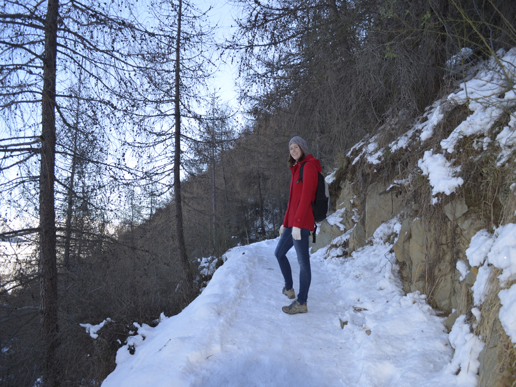
As we heard that the walk to the Mt John lookout is one of the best in the area, we decided to give it a try for our first full day in Lake Tekapo. Starting off at the Winter Park complex off Lakeside Drive, we decided to walk up through the larch trees via the Summit Circuit Track, however, it was really slippery to begin with walking on the compacted snow and ice!
Crampons would have been useful for climbing this icy slope!
Looking over the lake through the tree line
Mt John is 1031m above sea level and from what I read in a Department of Conservation leaflet, it's a roche moutonnée (small dome) formed by glacial ice flowing over it. The mountain was named after an early farmer in the district, John Hay, who used to run Tekapo Station, the first sheep farm in the Mackenzie Basin. Seeing as were already 710m above sea level to begin with it would only be another 321m to the top!
It was hard work getting through the forest but once we reached the top it was definitely worth the effort as there's a viewing platform where you can get spectacular 360 degree panoramic views of the surrounding mountains, Lake Tekapo and Alexandrina, and across the Mackenzie Basin flats.
The observation point above the larches
On the summit of Mt John
View of Lake Tekapo from the top of Mt John - click here to view in hi-res
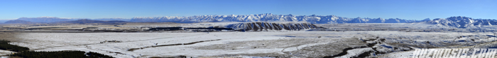
Panoramic view of the Southern Alps looking west- click here to view in hi-res
The Southern Alps extend as far as the eye can see
After soaking up the views, we then had a cup of tea and hot chocolate at the Astro Café by the Mt John University Observatory, which is operated by The University of Canterbury Department of Physics and Astronomy.
The internationally renowned Mt John University Observatory
Bit strange that the observatory doesn't want any aliens visitors!
Lizzie at the Mt John trig point
Mt John was chosen as the best site for an observatory housing the largest telescope in New Zealand due to the latitudinal position of the Mackenzie Basin as the southern sky can be seen continously throughout the year. Lake Tekapo also has a uniquely dark sky due to the stability and transparency of the atmosphere. UNESCO World Heritage status is currently being sought for the area as the first starlight preservation reserve.
View across to Motuariki Island ("motu" - island & "ariki' - chief)
Lake Alexandrina to the left and Lake Tekapo on the right
Continuing on from the summit, we then followed the track back down the eastern face of Mt John to the lakeshore. The further we walked round the lake the more stunning it became with the light of the setting sun shining over the mountains on the western shore and the moon rising from behind Mt Hay - it was a great way to finish the walk.
Mt Hay dominates over the eastern shore at 1173m
As mentioned previously, Lake Tekapo is one of the best places for observing the evening sky, party due to the consistently high ratio of clear nights, as well as being reputed to have the cleanest air in the southern hemisphere.
The night sky shot from Tailor-Made Backpackers
Lake Tekapo is reputedly one of the best stargazing sites in NZ
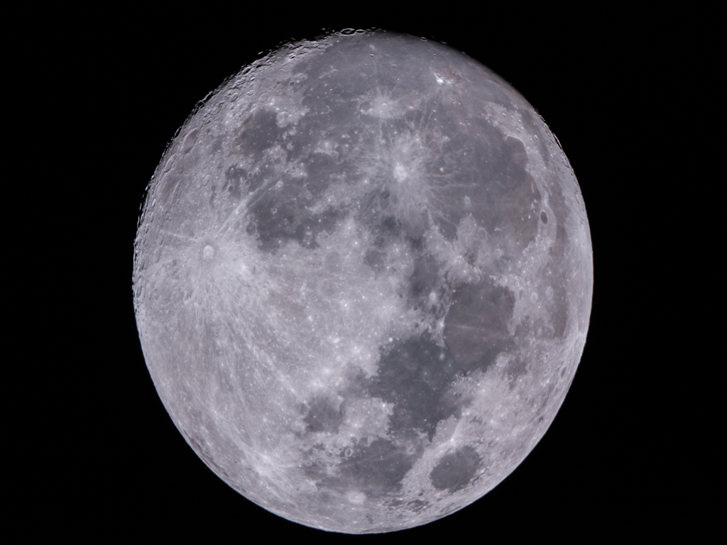
So, that evening we had an astrophotography lesson with renowned local photographer Fraser Gunn. As the moon was almost in its full phase and it was a clear night we took some detailed shots of the moon's surface in particular of the crater Copernicus, as well as a "nearby" star cluster M4 in the Scorpius constellation.
A near perfect full moon shot through a Tele Vue-60is telescope
Copernicus impact crater which can be viewed on Google Moon
M4 is one of the largest globular star clusters in our galaxy
As part of the lesson we were shown how to set up the camera attached to the telescope, align it and focus it on the moon or stars using some pretty nifty software, as well as processing several images on some photo editing software. It was massively geeky but very cool at the same time - I think I found my new expensive hobby!
Fraser explained that through his portfolio of work he was noticed by Mt John Observatory and was offered a job to be an astrophotographer. He also showed us some of the time lapse animations he created to show how the stars move on the earth's axis throughout the night as well as some amazing videos of the Aurora Australis (Southern Lights) over Lake Tekapo.
It was definitely the best two and half hours we spent and excellent value for money, as it was $40 for the first hour and then $20 per hour there after. If you ever stop through Lake Tekapo be sure to check if Fraser has availability as it's a much cheaper to way to do some star gazing than on one of the tours at the Mt John Observatory.
On our last full day in Lake Tekapo, we had read that down by Pioneer Drive, there's a sheepdog memorial and small stone church called the Church of the Good Shepherd (although unrelated to each other), which are both significant to the area, so we went down to the lakefront to try and find out more. The border collie statue was created as a monument by the run-holders of Mackenzie Country as a tribute to the farm dogs who made it possible for grazing on the mountains to take place.
Lizzie with one of the best known public monuments in New Zealand
A tribute to the farmer's best friend
The Church of the Good Shepherd is possibly one of the most photographed churches in New Zealand but trying to get a picture of the church without a hundred tourists in the shot was an absolute farce. Wave after wave of tour groups were being dropped off with people clambering to get a shot of the border collie statue, the lake and especially the church.
It's a very nice church but I don't quite understand what makes it such an important place for everyone to stop and see as they arrive into Lake Tekapo - it couldn't be for religious reasons as there were quite a few Asian tourists posing in front of the altar. One girl even asked if she could pay for $6 worth of postcards by EFTPOS or credit card - bearing in mind that Lake Tekapo is so small it doesn't have any banking facilities in the village!
One of the few shots of the church that I managed to get was of the view behind the altar, which perfectly frames the lake and the surround mountains. Giving up in frustration in trying to get a shot of the church without some random person photobombing it, we decided to do some snow tubing and check at the thermal pools at Tekapo Springs instead!
The alter at the Church of the Good Shepherd
One of the many consecutive coach loads of tourists at the church


superb post i like the most....
ReplyDeleteQueenstown Snowboarding