However, before booking our ticket to catch the Interislander ferry from Wellington, there was time for us to quickly pass through Taupō to see Mt Ruapehu at the southern shore of the lake in all it's glory. When we were here in February we couldn't see the volcano, so it was quite a spectacular sight to behold with the snow on it's peaks.
 |
| Mt Ruapehu is the North Island's highest mountain |
 |
| The mountain is actually an active stratovolcano! |
We also planned to drop into Napier to catch up with some friends and to do a small amount of work, as well as for Lizzie to do some volunteering at the SPCA (Society for the Prevention of Cruelty to Animals).
The drive from Napier down to the Interislander Ferry Terminal in Wellington is quite lengthy (over 300 km), so normally we would have stayed somewhere closer to Wellington or even in the capital itself, but it's more expensive to stay there than anywhere else in the country. If we did decide to stay in Wellington then we would have liked to have been there for a couple of nights so we could see some of the sights, but we're just keen to get onto the South Island now as we've spent more time on the North Island than we had in the whole of New Zealand the last time we were here.
Starting off at 7am (yes, it's bloody early but we needed to be at the ferry terminal for 1.30pm) we drove through Hastings out towards the beautiful mountain ranges of Central Hawke's Bay at Ongaonga alongside the Ruahine Forest Park. Passing through Southern Hawke's Bay on State Highway 2 there were a relentless number of sheep and cattle stations but there was little of genuine interest. At Mangatainoka we drove past the famous Tui Brewery and the "Frank the Tank" grain silo at Mangatainoka.
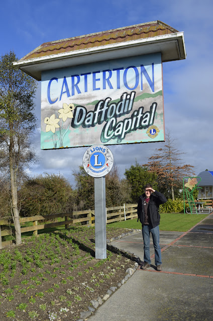
Continuing on our journey, we stopped off very briefly in Carterton in South Wairarapa, the namesake of the nearest town to us back at in home in Witney! Unfortunately, there's not much to write home about (a bit like back in England) for the self-proclaimed Daffodil capital of New Zealand but it's funny to think of friends back in Carterton, Oxfordshire 11,700 miles away.
 |
| This is for Ben and Aaron back in Oxfordshire! |
Once we arrived at the ferry terminal we waited for over an hour and a half before the ferry finally left Wellington despite being warned to arrive in good time before the final check-in. We were so bored waiting to board the ferry I decided to go for a nap in the car but before long as I was being rudely awaken by Lizzie as the vehicles were boarding the ferry and we were holding up the queue!
It's quite expensive to take a car on the ferry but we were able to get a discount through booking a non-refundable web saver fare and a additional 10% off using our BBH backpacker club cards.
 |
| Lizzie with the Lancer at the windy ferry terminal |
Wellington Harbour (Te Whanganui-a-Tara or Port Nicholson as it's technically known) is a large natural harbour surrounded by hills and with a narrow entrance to the sea guarded by the Barrett Reef. In Māori tradition the explorer Kupe is said to be the first person to visit the harbour. Our ferry for sailing across the Cook Strait (Raukawakawa) was the Aratere (or Māori for "quick path") which was recently lengthened in Singapore in 2011:
The Cook Strait connects the South Pacific Ocean and the Tasman Sea through the centre of the New Zealand land mass. Great oceanic currents sweep up the coast of the South Island and funnel through the channel between Cape Terawhiti on the North Island and Arapawa Island at the entrance to the South Island's Marlborough Sounds. As a result of the strong swells, the crossing is famous for being quite rough, although we must have been quite fortunate as it was a relatively smooth journey.
Entering the drowned valleys of Marlborough Sounds through the Tory Channel, our final destination was the sleepy town of Picton in heart of the Marlborough Sounds. Unfortunately, it had got too dark for us to see any of the Queen Charlotte Sound, so we might have to save this for the return journey! Picton is a good base to tackle the Queen Charlottle Track - supposedly one of the best walks to do in New Zealand, however, it was something we never did when we were in the Marlborough region five years ago.
 |
| The bow of the Aratere heading for the Marlborough Sounds |
 |
| Arapawa Island on the horizon |
 |
| Sunset over the Marlborough Sounds |
The journey across the Cook Strait brings an end to our travels in North Island but the map below highlights all the places we've visited.
 | |
|


No comments:
Post a Comment